GIS Services


CAD DRAFTING-DESIGNING-CONVERSION:
Azee Ssytems provides a full range of CAD Services, including conversion, 2D drafting, 3D modeling, rendering, animation, and Sketch-up. We help our clients to save time by providing CAD conversion services. With the help of this service, our clients from different background like engineering, mechanical and architectural get benefited by converting their drawings in the digital format. If you have any issue for raster image scanning, 3D drawings or 2D drawings, we can solve it easily with CAD conversion.
With the help of CAD, editing digitized format has become a reality and it also allows saving for the editing or modification of works that might be required in the future. If the conversion is done in the 3D format then it is possible to view the whole project even without a single construction. Thus, helping in plan in advance and make required changes before starting the project.
Azee Systems offers specialized CAD services in following areas:
| Paper to CAD Conversion | Image to CAD Conversion | PDF to CAD Conversion | DWG to DGN/DGN to DWG Conversion |
| 2D to 3D conversion | Any file format to desired output | 3D modeling and renderings | Raster to vector conversion |
| Hand sketches to AutoCAD | AutoCAD conversion | MicroStation Conversion | JPG, Tiff to DWG Conversion |
| MCD, PDF to DWG conversion | Architectural drawings | Sketch-Up to CAD Conversion | AutoCAD Digitization |
| AutoCAD Drawings | Scan to CAD Conversion | Raster to vector conversion | PDF to DWG conversion |
BIM (BUILDING INFORMATION MODELING)/ARCHITECTURAL SERVICES:
Azee Systems offers full range of Building Information Modeling (BIM) services; and specialize in delivering end-to-end Revit BIM services and solutions for your building construction projects.
With the help of our expertise in BIM and Revit services, you can now remodel and recreate interiors with interactive photorealistic 3D model architecture. Our teams of dedicated 3D modelers streamline the processes across the building’s lifecycle, ultimately empowering clients with a complete view of the construction project.
Azee Systems offers specialized BIM/Architectural services in following areas:
| Architectural CAD Draftings | Architectural Designing & Detailing | Architectural Design Conversion | Architectural Drawings |
| Architectural Renderings | Home Plan Drafting | House Plan Draftings | Site Plans |
| Floor Plans | Piping Design and Detailing | Elevations and Sections | Construction Documents/Working Drawings |
| Foundation Plans | Roof Framing Plans | Roof Framing Plans | Construction Drawings |
| As-Built Drawings | Duct Workshop and Drawings | Piping Layout Designing & Detailing | Plumbing Layout Designing & Detailing |
GIS-GEOSPATIAL AND REMOTE SENSING:
Azee Systems provides a full range of GIS and Remote Sensing Services globally. GIS Services can help in the design, development, and implementation of a GIS System for your company regardless of size. Our Geospatial Services includes high quality GIS data for our prospect-customers and appreciated partners within their budget. This is most important for successful completion of our projects.
Our goal is to ensure each and every client receives the highest possible level of quality and service, at a rate well below what they would pay for in-house or domestic services.
Azee Systems offers specialized GIS & Remote Sensing services in following areas:
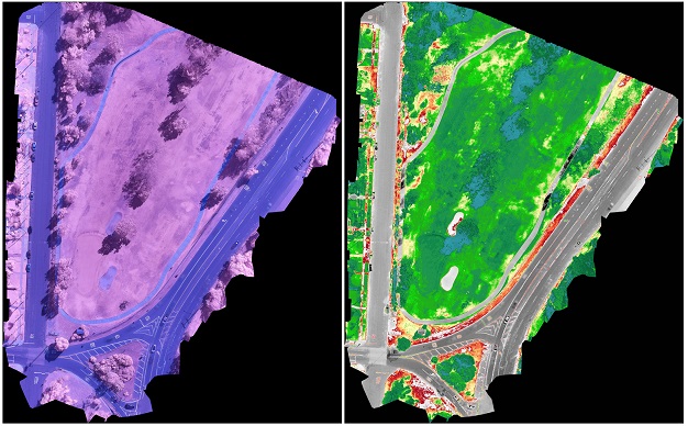
| Aerial Mapping | Parcel Mapping | 2D Building Digitization | Image Interpretation-Processing-Classification |
| Satellite Image Rectification | Satellite Image Tiling and Color Balancing | Cadastral Mapping | Geo-Referencing & Geo-Coding of Database |
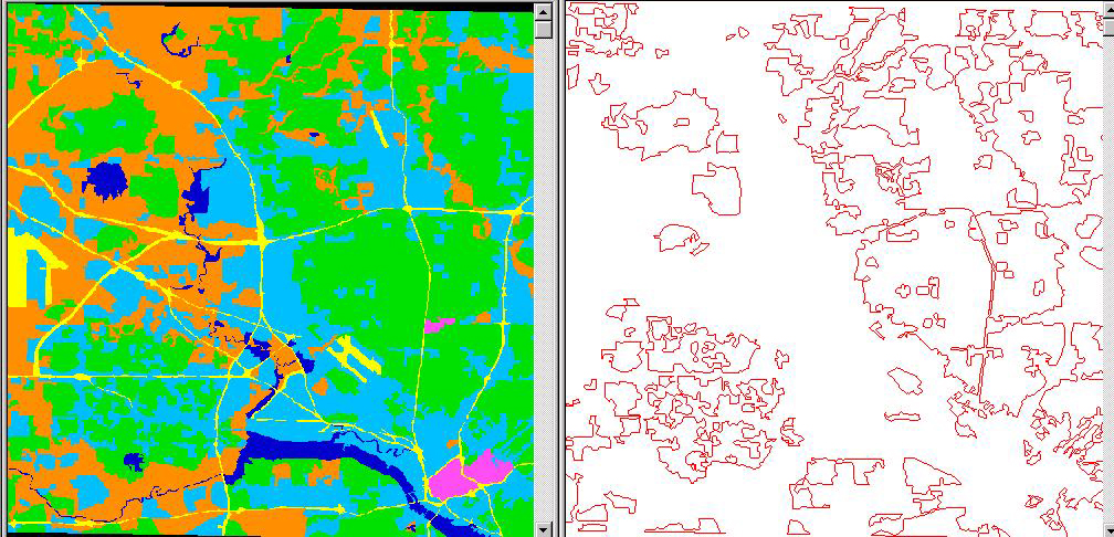
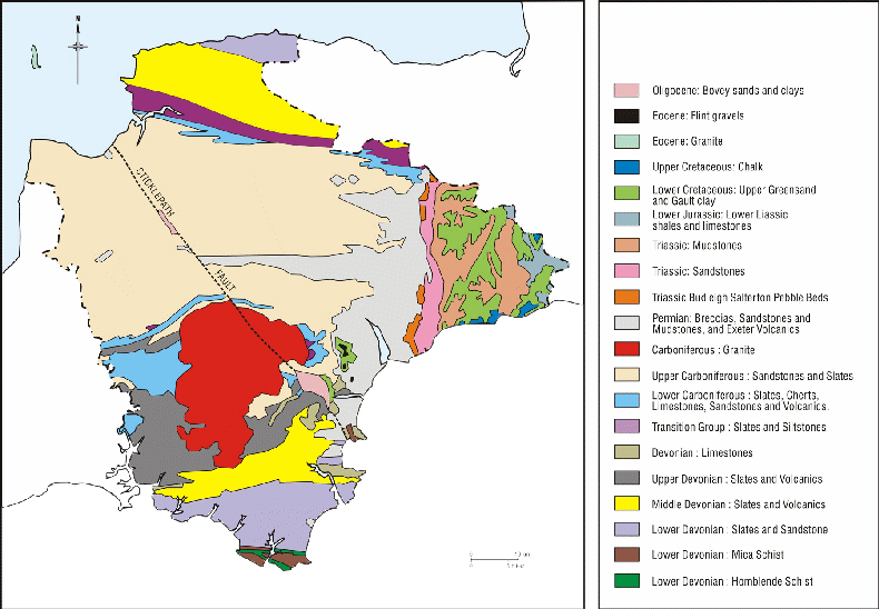
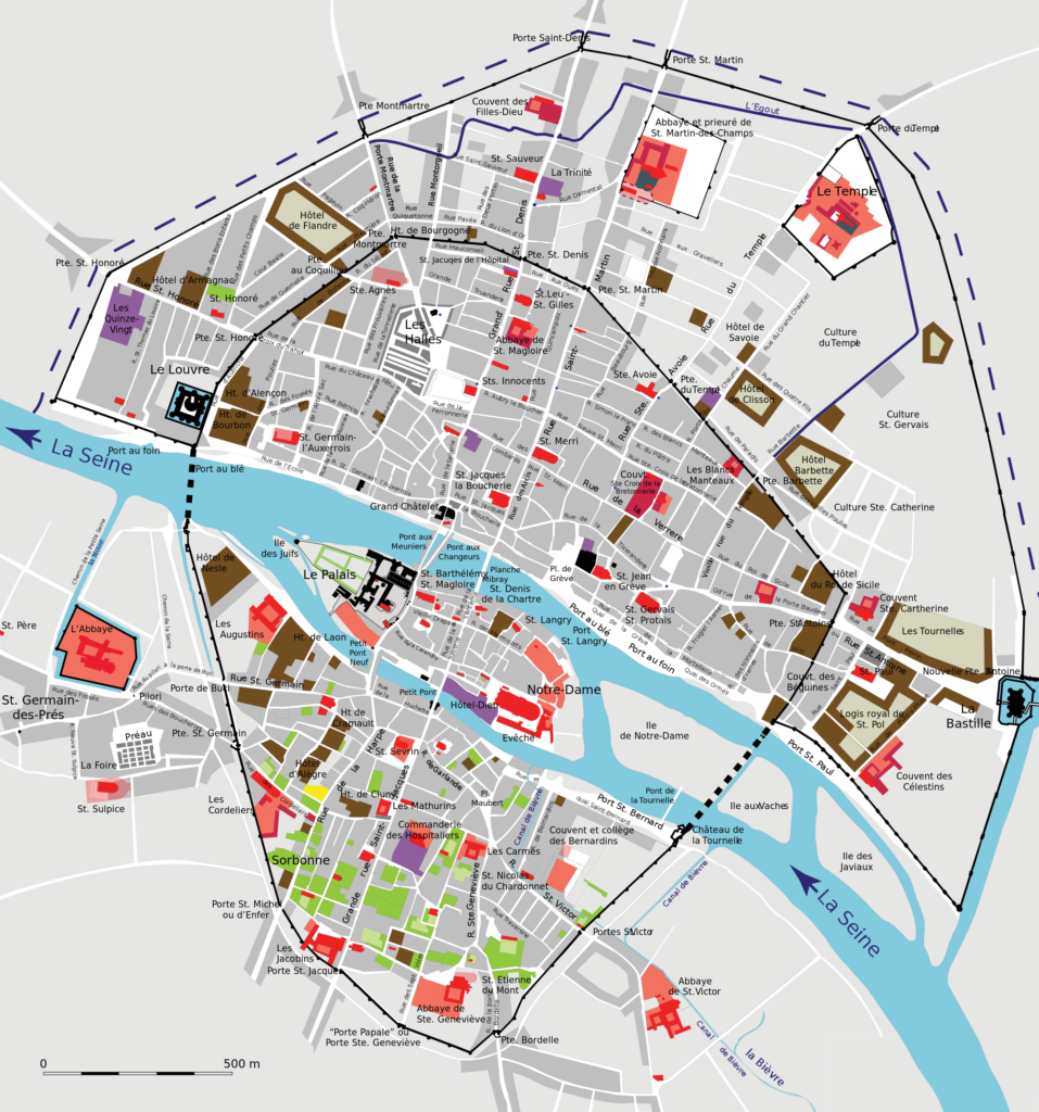
| Contour Mapping (DEM & DSM) | GIS Data Management-Mapping | Geological Mapping | Cartographic Mapping |
| Land Use/Cover Mapping | Landscapes and soil resources assessment | Flood Plan Mapping | Utility Network Mapping |
| GPS Golf Course Mapping | Urban Planning-Mapping | Location Based Services (LBS) | Agriculture-Forestry Mapping |
| Fire and Emergency Mapping | Transportation Mapping | Water Waste Resources-Management-Mapping | Digital Mapping |
| Automated Mapping/Facilities Management | Topographic Mapping | Custom Mapping | Revenue Mapping |
| Thematic Mapping | Planimetric Mapping | Data Automation and Integration | Analysis For Geosciences & Data Processing |
LiDAR (ALS & MLS) MAPPING SERVICES:
Light Detection and Ranging (LiDAR) can determine how far objects are away from each other by shining a laser onto a target and analyzing the light that bounces back. LiDAR is used to create incredibly detailed maps in addition to assisting researchers in the fields of geography, archeology, geology, seismology, atmospheric sciences, laser studies, and much more.
LiDAR Data processing is most effective in the field of geographical system and of remote sensing for creating Digital Elevation Model, Digital Terrain Model and many other surface models. We have the complete understanding of all types of data in LiDAR system and has developed custom built utilities for easy classification of LIDAR points.
ASI is proficient in providing following LiDAR Mapping Services:
| ALS (Air Bourne Laser Scanning) Data Processing and Classification | MLS (Mobile Laser Scanning) Data Processing and Classification | MLS (Mobile Laser Scanning) 3D Data Processing, Classification Vectorization | Power Line 3D features Data Processing, Classification Vectorization |
| Urban corridor Mapping | Rail Corridor mapping from point cloud data | Vegetation Mapping Classification and Vectorization | Building Extraction Classification and Vectorization |
| Impervious/Pervious Surface Mapping/Classification and Vectorization | DTM (Digital Terrain Model) filtering from DSM (Digital Surface Model) | Bathymetry Classification and Vectorization | Ground Classification, Contour Generation and Vectorization |
| Mobile Mapping | Highway Infrastructure Mapping | Building, Roads, Hydro, Vegetation Classification & Vectorization | Rail Tracks, Rail Power-line, wires, Structures, other objects Classification and Vectorization |
DIGITAL UAV SERVICES:
Digital UAV, as its name implies, is a 3-dimensional coordinate measuring technique that uses photographs as the fundamental medium for metrology (or measurement). The fundamental principle used by Digital Photogrammetry is triangulation or more specifically called Aerial Triangulation. By taking photographs from at least two different locations, so-called “lines of sight” can be developed from each camera to points on the object. These lines of sight (sometimes called rays owing to their optical nature) are mathematically intersected to produce the 3-dimensional coordinates of the points of interest.
By the use of Digital Photogrammetry, mapping, map updating and 3D city models are processed. At ASI, the focus areas in Digital Photogrammetry are direct Geo-referencing, the use of digital photogrammetric cameras in mapping, radiometric calibration of digital aerial images, extraction of building outlines and integration of laser scanning and photogrammetry.
ASI is proficient in providing following Digital Photogrammetry & UAV Services:
</tr >
| Digital Aerial Triangulation (DAT) | Digital Elevation Model Creation (DEM) | DTM & DSM & Orthoproduct Generation & Editing | Ortho Photo Creation & Rectification |
| Topographic Map Creation | Planimetric Feature Extraction | 3D Vector Mapping | Digital Ortho Photography |
| 3D Projection & Mapping | Forest/Architectural Mapping & Analysis | Digital Aero Triangulation | 3D Planimetric/Topographic Mapping |